
Building Intelligent Spatial Infrastructure for a Connected World

Building Intelligent Spatial Infrastructure for a Connected World

The geospatial industry has transformed from a specialized area of cartography into a key component of the global digital economy. Geographic Information Systems (GIS) now serve as the spatial framework for managing global supply chains and local utility networks. Demand for these solutions continues to grow as organizations increasingly recognize the value of location-based insights for operational efficiency, environmental responsibility, and strategic planning.

Delivering Speed, Precision and Scale in Lidar Mapping

Delivering Speed, Precision and Scale in Lidar Mapping

For executives responsible for acquiring lidar mapping solutions, the challenge rarely lies in access to technology itself. The constraint emerges in how quickly and reliably that technology can be deployed, translated into usable data and distributed across decision-making teams. Infrastructure expansion, renewable energy development and large-scale land transformation projects depend on timelines that leave little room for delay, yet many providers still operate within fragmented workflows that extend delivery cycles from weeks into months.

LiDAR Mapping: Elevating Infrastructure Development and Environmental Management

LiDAR Mapping: Elevating Infrastructure Development and Environmental Management

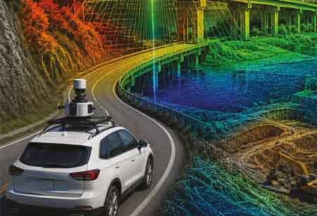
LiDAR mapping solutions have become an essential component of infrastructure modernization, environmental resilience, and strategic land development. As public agencies, engineering firms, agricultural operators, and utility planners require increasingly accurate spatial intelligence, LiDAR technologies continue to evolve in performance, integration capability, and analytical depth.

Building Enterprise-Grade Location Intelligence: A Guide to Modern GIS Development

Building Enterprise-Grade Location Intelligence: A Guide to Modern GIS Development

Geographic information systems have moved far beyond cartography. For executive teams responsible for infrastructure, public services and complex networks, GIS now sits at the intersection of data governance, analytics and enterprise systems. The challenge is no longer whether spatial data matters, but whether it can be trusted to support daily operations, regulatory obligations and long-term planning. Many organizations still rely on fragmented desktop tools, isolated databases and legacy servers that limit scale and visibility. That gap between ambition and capability defines the current market for advanced GIS development.

Top